Field report · Waterton to Napa Valley, western North America
The long road from Waterton to Napa
Sixteen days by road from a mountain lake in the Canadian Rockies to a valley of vineyards in California, with hot springs, hoodoos and a salt flat in between.
Waterton to Napa Valley
We started this one at a lake and finished it at a vineyard table, and in between we drove through most of the versions of the American west at once: glacier-carved mountains, boiling mineral terraces, red rock amphitheaters, and a salt flat lower than the sea.
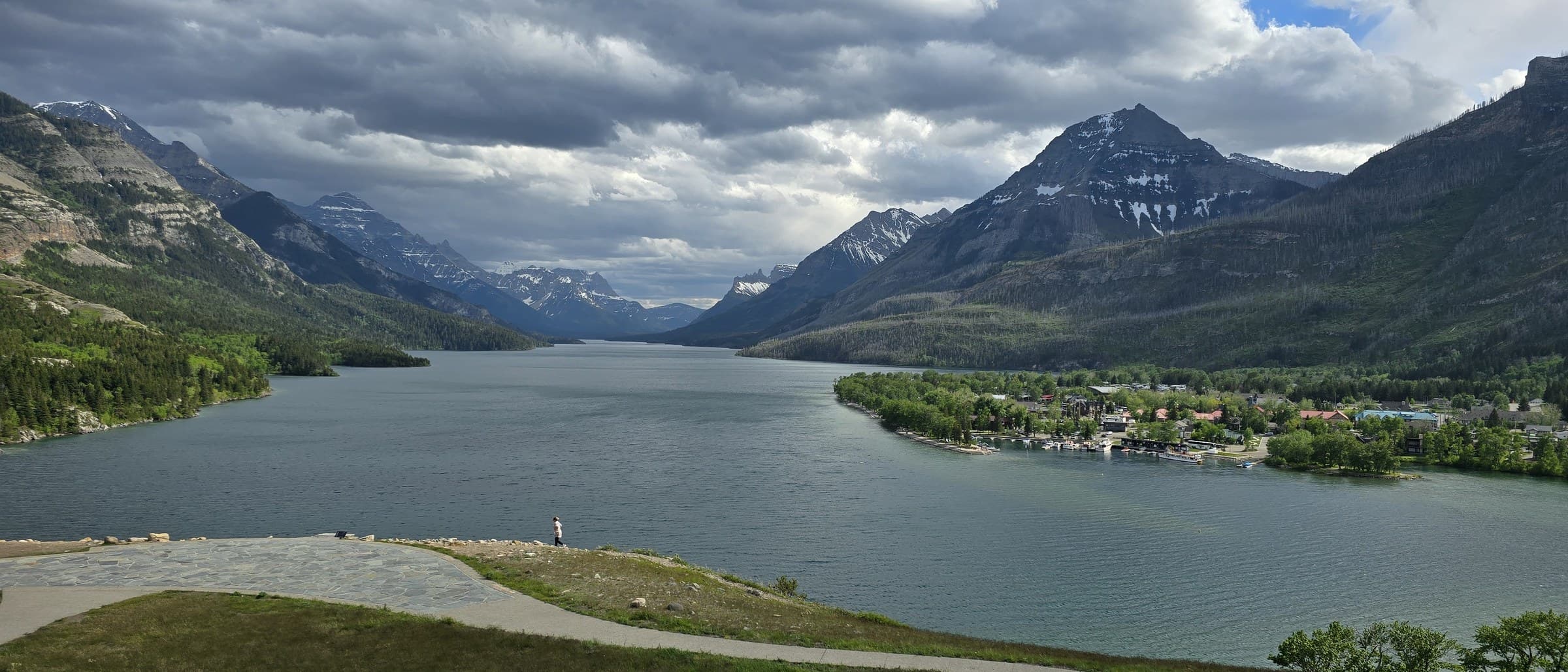
The trip began at Waterton, on the Canadian side of the Waterton-Glacier corridor, with a climb up the hill above the Prince of Wales Hotel for a look back at Upper Waterton Lake and the townsite below it. Storm light was moving over the peaks that first evening, the kind of scene that makes it hard to believe there are fifteen more days of driving ahead.
From there the route ran south and west for over two weeks, loosely following a shape mapped out beforehand: Yellowstone, the red rock parks of southern Utah, Death Valley, and on to California's wine country. Loosely, because the best stop of the whole trip was one that wasn't on that map at all.
“Some of the best stops on this trip were never on the itinerary in the first place.”
From the journalMountains into geysers
The first few days stayed in mountain and forest country: a waterfall stop and a forest trail near the Waterton-Glacier corridor, then south into Yellowstone. At Mammoth Hot Springs we walked the boardwalk above the travertine terraces, sheets of orange and white mineral rock built up by the hot springs over centuries, the kind of landscape that looks more like a painting than a photograph until you're standing on it.
A day later we found ourselves at a stone-walled frontier fort somewhere in the Yellowstone corridor, and not long after that at a brunch stop with a cocktail menu built around Grand Teton huckleberry vodka, a small sign that we were still deep in Wyoming's high country. The day after that was a big driving day through rugged, forested mountain terrain, one of the long transit stretches that road trips like this one are made of.
Red rock, and then more red rock
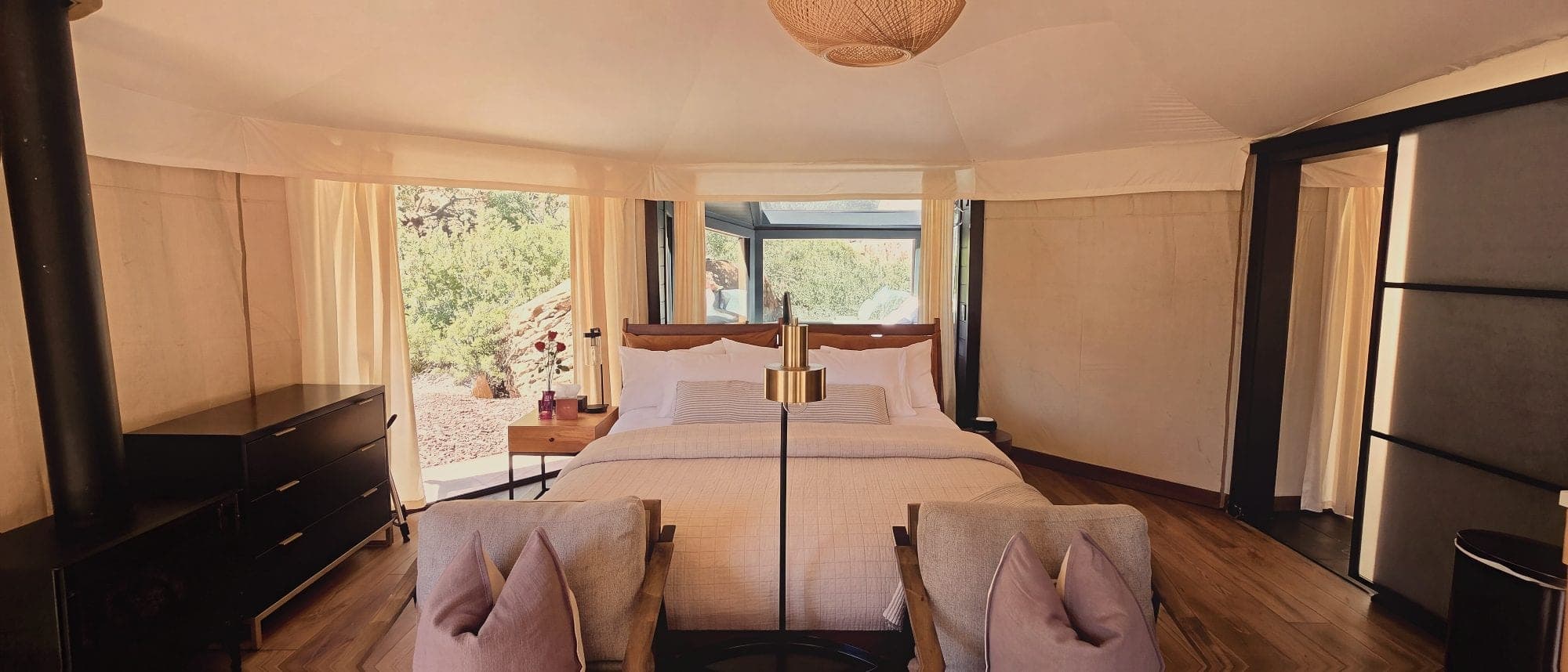
The landscape changed fast after that. We checked into a glamping tent tucked into a red sandstone canyon on the edge of Zion, canvas roof, timber posts, juniper scrub all around it, the sort of place that makes the case for glamping over camping without saying a word.
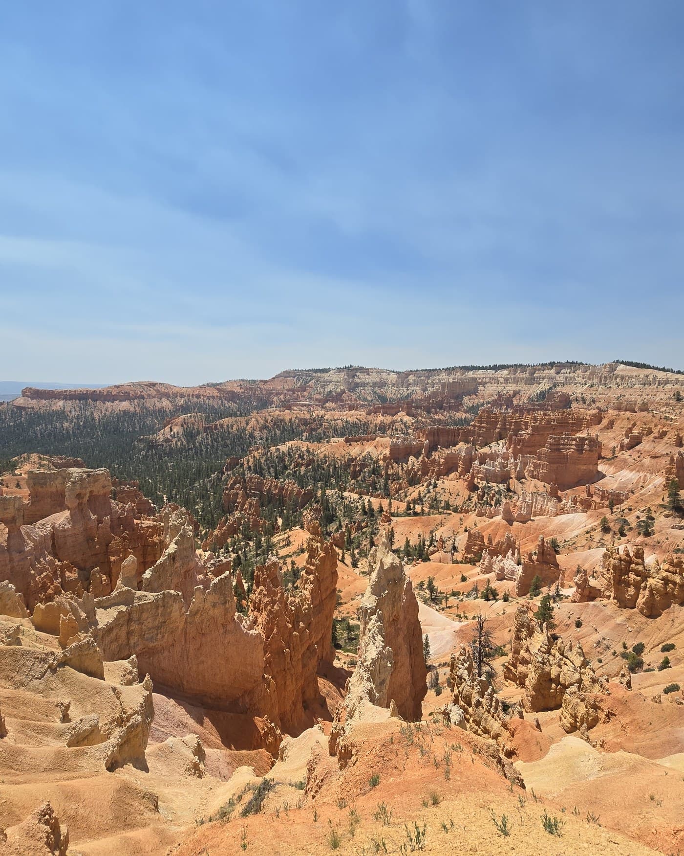
The next morning we found Bryce Canyon National Park, which hadn't been on the original plan. We stood at an overlook above the amphitheater of hoodoos, the tall, thin rock spires the park is known for, and it turned into one of the best hours of the whole trip, unplanned as it was.
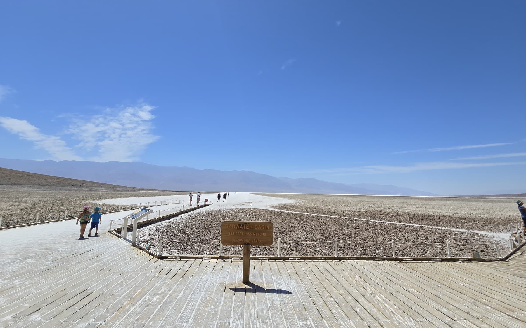
From there the road ran through a stretch of red sandstone highway, likely Nevada's Valley of Fire, before dropping into Death Valley. At Badwater Basin we stood next to the trailside sign that spells it out plainly: 282 feet, 85.5 metres, below sea level, with a white salt flat stretching out behind it and mountains beyond that. It's one thing to read the number on a map and another to stand on it.
West to the water
Death Valley gave us one more classic road-trip image, an open desert highway running straight to the horizon, before the route turned toward the coast. Lunch that day was ahi tuna poke tacos, jalapeno, corn and guacamole piled onto crispy wonton shells, a welcome change of temperature and colour after two days in the desert.
The days that followed took us through the Southern and Central California coast: a Spanish-mission-style building with a rose garden on an overcast morning, and a wooden pier over the Pacific at golden hour. By the evening of 20 June we were in San Francisco, eating a baked empanada out of a paper bag stamped El Porteno, Empanadas Argentinas, San Francisco, standing on a street corner because we hadn't planned to sit down for it.
“From two hundred and eighty-two feet below sea level to a glass of something local, all in four days.”
From the journalThe valley table
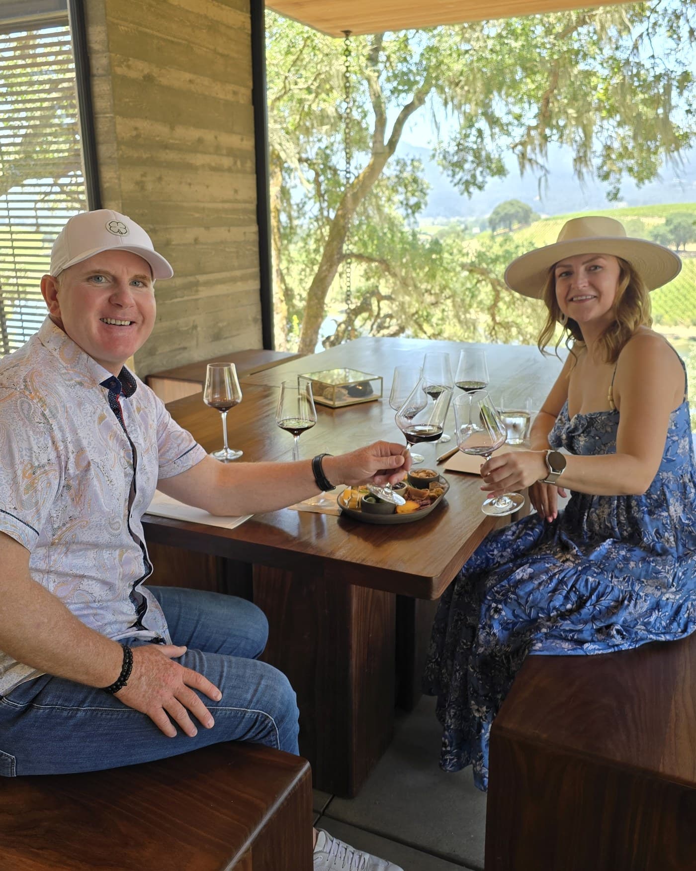
Napa Valley closed out the trip. We spent an afternoon at Caymus Vineyards, ivy climbing over the signage, glass in hand with rolling vineyard rows and dry golden hills behind us, and another at a wine-tasting table under oak trees strung with Spanish moss, a small-bites board between the two of us and the valley laid out below the pavilion.
The next day was Hog Island Oyster Co., a shucked platter with lemon and a menu that named where each oyster had come from: Marshall, Napa, San Francisco. The last two nights were slower, a river-view lodge with a pool and hanging flower baskets in wine country, and a foggy, early drive along the coast highway on the final morning, the kind of grey, quiet start that makes a good last chapter for a trip like this one.
Waterton to Napa Valley. Our own photographs from the trip.
We left Waterton in storm light and finished in a valley of vines, and everything in between, the terraces, the hoodoos, the salt flat, the empanada eaten standing up, is what we'd point back to if anyone asked why this one took sixteen days instead of a week.
From the journal · The Travelling T · Went June 2024